2022 University of Delaware Student Competition for
Geospatial Data Visualization / Map Design
This is an annual recurring event sponsored and administered by the Department of Geography and Spatial Sciences (GEOG) and the Data Science Institute (DSI) at UD. The 2022 cycle is now complete. UD students at all levels entered the university-wide competition for achievements in the art and science of mapping geospatial data. Here is the archived call for submissions which were closed on Oct 1, 2022.
The 2022 Winners
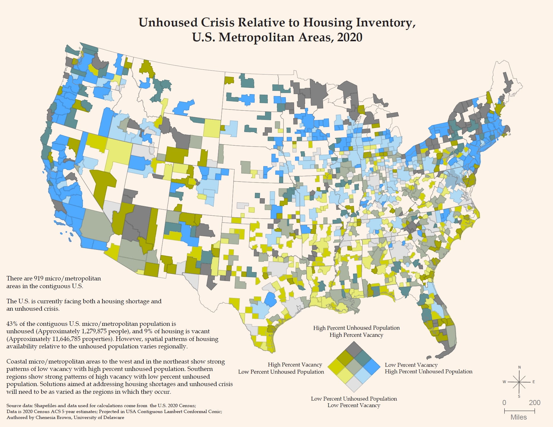
Winner: Chenesia Brown (clbrown@udel.edu), Ph.D. in Sociology, Class of 2023
Map Title: Unhoused Crisis Relative to Housing Inventory, U.S. Metropolitan Areas, 2020
Background: This is a bivariate choropleth map that shows spatial patterns of housing in U.S. micro/metropolitan areas. This map uses a matrix of colors to represent two distinct variables: Percent Unhoused Population and Percent Vacancy. Percent vacancy is represented as light (low) to dark (high) values of a yellow hue, while percent unhoused population is represented as light (low) to dark (high) values of a blue hue. Areas with high rates of both variables, low rates of both variables, and areas with an asymmetric relationship between the two mapped variables are represented as light (low) to dark (high) values of a grey hue. Percentages were calculated in ArcGIS Pro using 5-year U.S. census estimates. Housing units are considered vacant if no one is living in it at the time of census interview and/or if it is a temporary residence (meaning someone resides in it two months or less at a time). Unhoused is measured by counts of people living outdoors and at other locations where they are known to sleep/service locations (e.g., emergency and transitional shelters, soup kitchens, regularly scheduled mobile food vans).
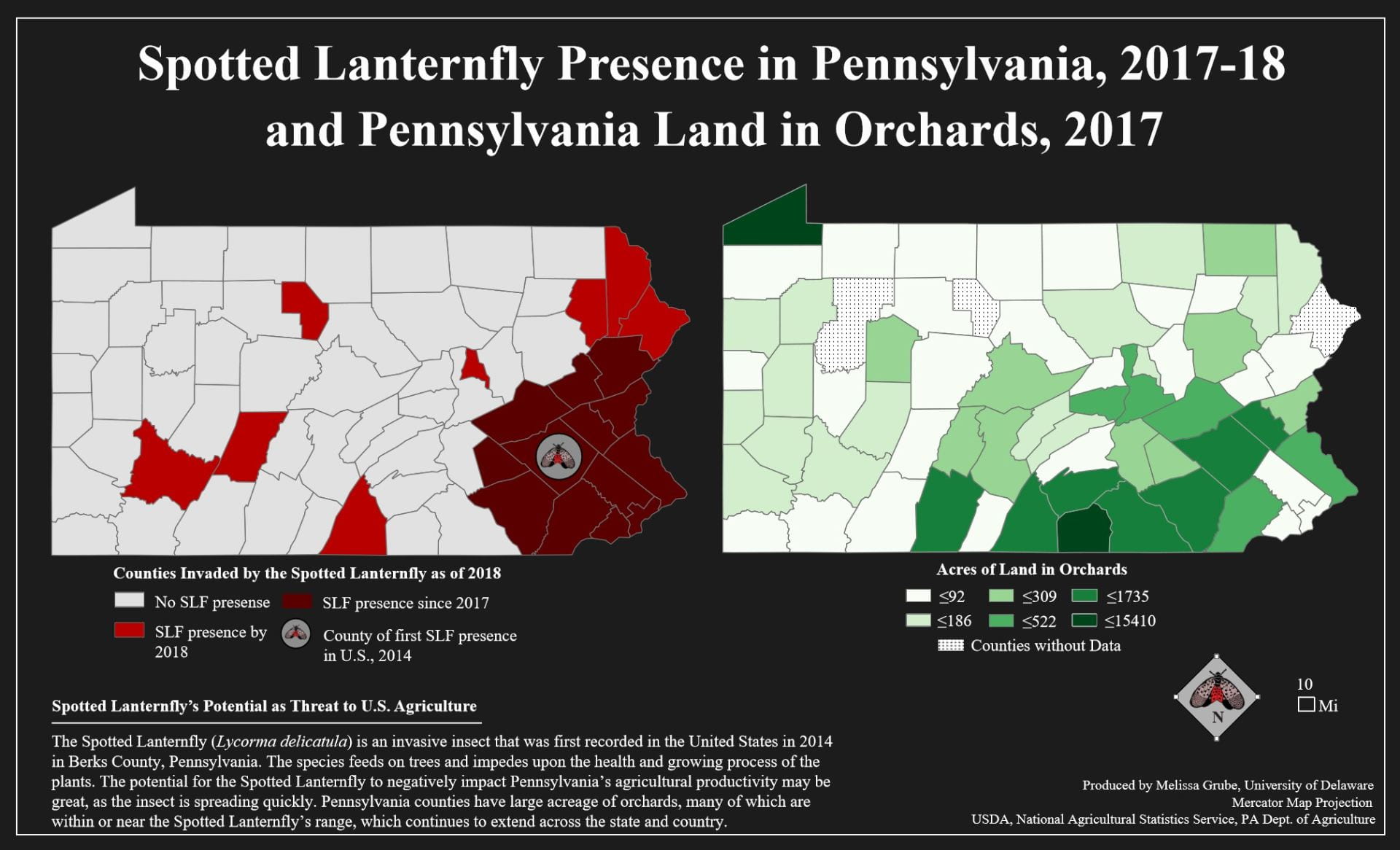
Runner Up: Melissa Grube (mgrube@udel.edu), B.A. in Geography Education, Class of 2023
Map Title: Spotted Lanternfly Presence in Pennsylvania, 2017-18 and Pennsylvania Land in Orchards, 2017
Background: My map entry is comparing the spread of the Spotted Lanternfly to the acreage of orchards in Pennsylvania counties in 2017-2018. The insect is invasive and has the potential to be very damaging to crops, particularly fruit trees. The latest data on orchard acreage was from 2017, however each year the Spotted Lanternfly range data is updated. Since 2017, the insect’s range has extended significantly to more PA counties. Without recent orchard data available, this map simply represents the potential threat that the insect has on U.S. agriculture, rather than the impact it has already had. I chose to use a simple side-by-side choropleth design in order for the attributes to be easily compared.
Honorable Mentions:
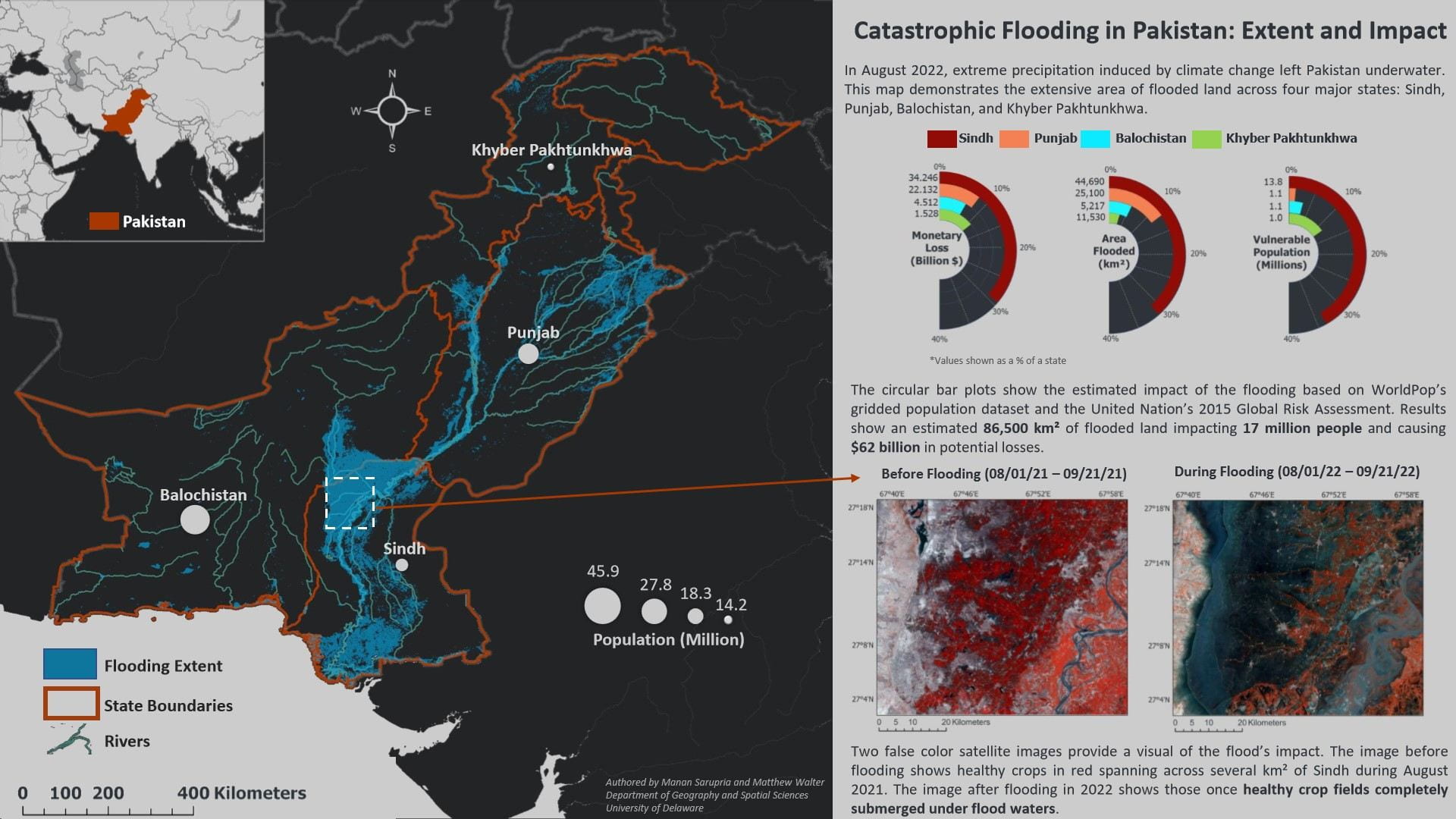
Catastrophic Flooding in Pakistan: Extent and Impact
Manan Sarupria (manansarupria599@gmail.com), Ph.D. student in Geography
Matthew Walter (mswalter@udel.edu), Ph.D. student in Geography
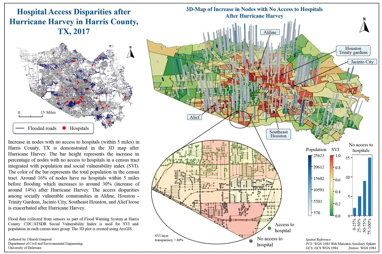
Hospital Access Disparities after Hurricane Harvey in Harris County, TX, 2017
Utkarsh Gangwal (utkarsh@udel.edu), Ph.D. student in Civil and Environmental Engineering
Prize
- Cash awards and acknowledgement certificates for a winner ($300) and a runner-up ($200)
- Competitive entries are featured right here on the competition webpage and at UD GIS Day (Nov 16, 2022), and used by UD educators as examples of excellent map design (with permission)
Eligibility
- The map entry must have been completed between Sep 1, 2021 and Sep 30, 2022 (roughly, the past academic year)
- You do not have to be a student at the time of the submission, but you must have been a UD student when you completed the map
- Students may submit multiple entries, but may only win one prize
- Group work is eligible, but the maximum number of students working on a single map is two
Judging Criteria
Map entries are judged on clarity, originality, and creativity in both the art and the science of mapping, while appropriate use of geospatial data and technologies is a must. All entries are judged by an expert panel of geospatial data scientists at UD. The award will be announced near the end of October.
Past Winners
Further questions about the competition can be directed to Dr. Jing Gao (jinggao@udel.edu).


